Loading...
Loading...
Loading...
...
Swanston, City of Edinburgh
Hi, Srinivasan here. This is my account of a recent hike I did on March 8th in the Pentland Hills, Scotland, near Edinburgh, United Kingdom. This was my fourth trek of the year. I've made it a policy to go on at least one trek each month, so this was my fourth. It's been two or three years since I last visited the Pentland Hills, and even longer before that—four years, maybe more. I was determined to make this trip happen, regardless of who could join me. Initially, I planned to go on March 7th, but that didn't work out, so I pushed it to March 8th.
I was well-prepared, having gone to Decathlon a week earlier to buy necessary gear—mainly weatherproof jackets, track pants with fleece, and proper hiking shoes from Merrill Gorex, which were excellent. I brought spare clothes just in case, and I packed a proper lunch with an insulated hot box containing lentil rice and boiled eggs. As usual, I packed three liters of water: one liter of coconut water (my electrolyte for day hike) and two liters of plain water. I also had a head cap, gloves, and other minor essentials. This time, I brought a spare pair of shoes for walking on flat ground, as hiking shoes can be uncomfortable for extended periods.
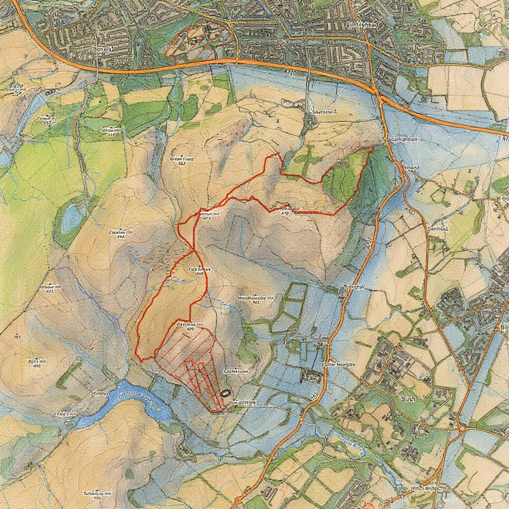
By 10 o'clock in the morning, I caught the bus to the foot of the Pentland hill, which took about 45 minutes. Instead of stopping at the foot of the hill, the bus climbed up to the ski base camp. Previously, there were no bus routes to this location, so it was a pleasant surprise. Myself and another couple were the last ones on the bus, and we remembered that it used to stop at the hill's base. We inquired with the bus driver, but he had no idea. We decided to ask at the ski base camp, where they pointed us in two directions. We thanked them for their help.
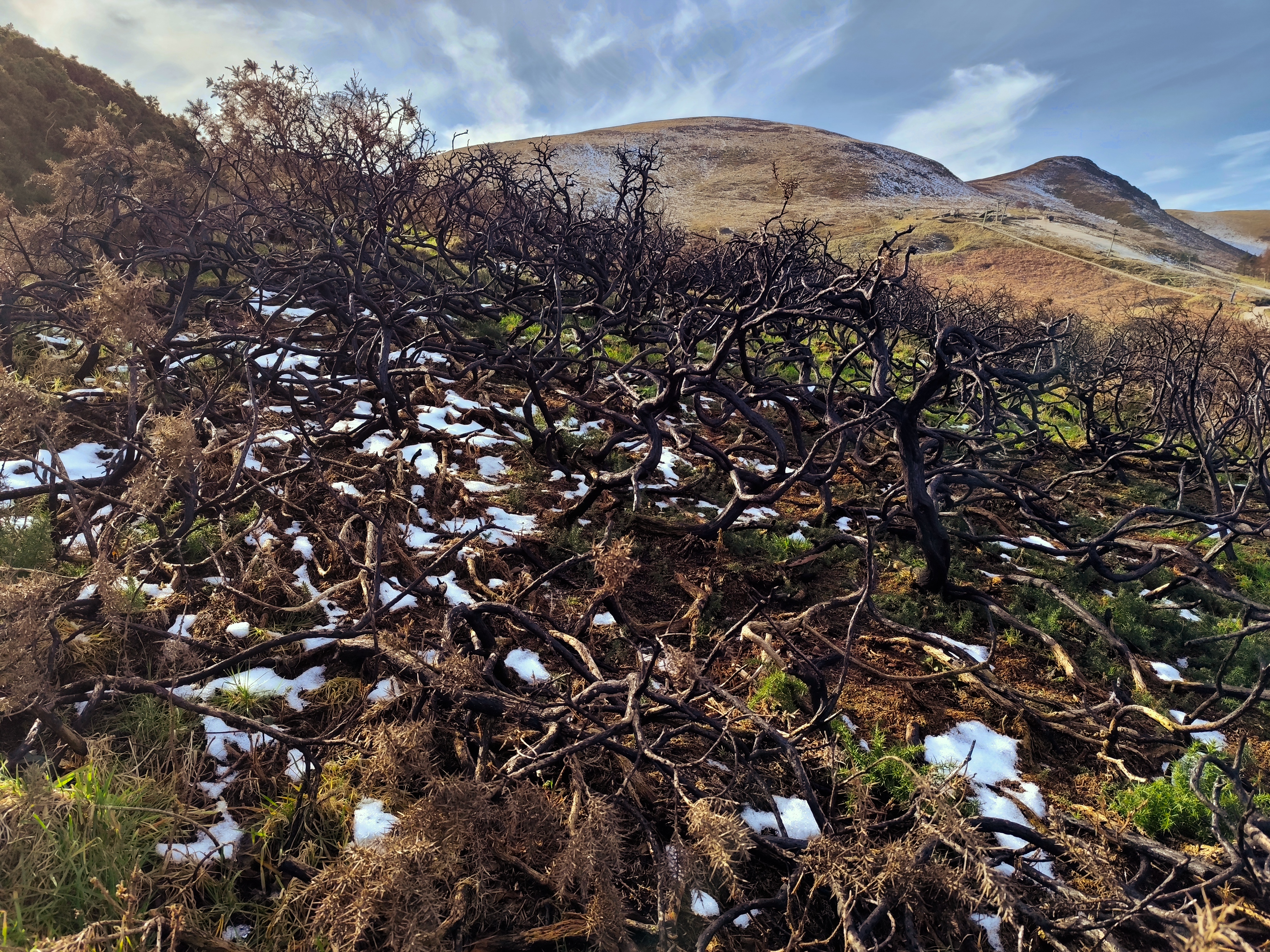
After leaving the ski camp, I switched into my trekking shoes and told the couple to carry on without me. Once ready, I followed them down the hill and recognized my old route. The weather was chilly, but my insulated jacket kept me warm. After climbing two small mounds, my body warmed up, and I was ready to pace myself. Usually, there are about 20 to 30 people on this route, but I saw no one, likely due to the cold. I met a couple of joggers and walkers with their dogs along the way. After crossing the half-kilometer mark, I was pretty much alone, which I decided to enjoy as a solo trip.
About 200 meters later, I encountered a large group of women hiking. I took a break, had a sip of water, and snapped some photos. Not wanting to lose my pace, I continued on, eventually facing a steep climb at a 70-degree angle. I took three breaks, and during one, I exchanged words with two couples who encouraged me, saying it was the toughest slope, and once past it, the route would be easier. I thanked them and reached the toughest peak of the entire stretch, feeling a sense of achievement.
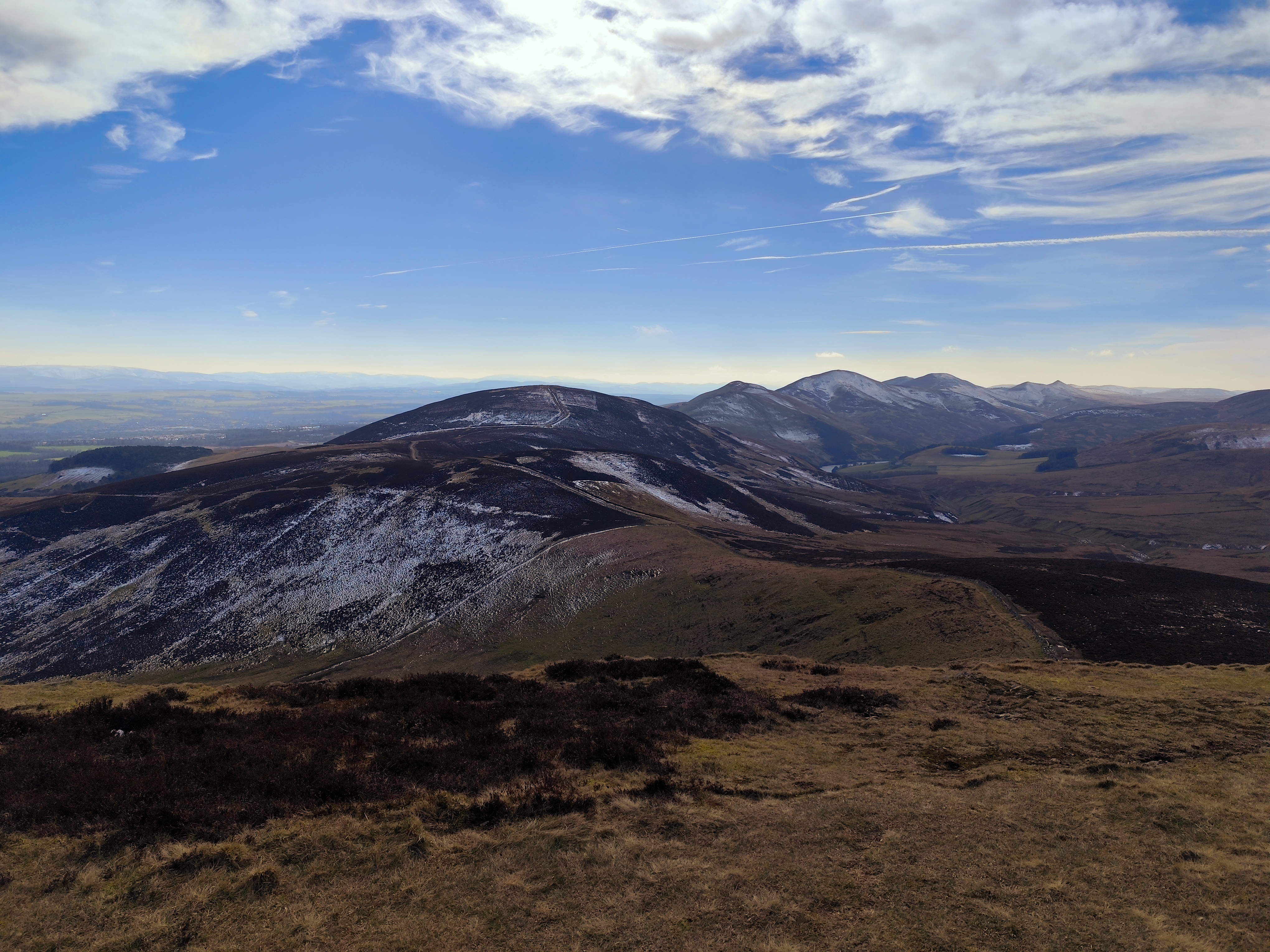
From there, the path became relatively easier. To reach the tallest peak in the Pentland Hills, I needed to cross another two hills, about a four-kilometer stretch. Once I reached the peak, the view was stunning, with a chain of hills stretching south, partially snow-covered, with the feel of accomplishment. There was a small reservoir in view, too. My initial plan was to cover either all three reservoirs or just one. By 1 p.m., I took a break, drank coconut water—my recent electrolyte replacement—and enjoyed the replenishing feel.
I had packed two chocolates as snacks: one orange-flavored and one dark chocolate. After a 10 to 15-minute break, I decided to head to the next peak to enjoy the view. After crossing two small hills, I encountered two paths: one steep climb to the left and an easy valley to the right. The right path offered a view of seven continuous hills, but I hadn't explored the entire stretch yet. The left path led to another peak with a view of the reservoirs. I chose the left and reached the military range, clearly marked and fenced.
By 2 p.m., I met two couples having lunch. I decided to take a break, but the ground was freezing. I used my spare shoes as a seat, and despite the wind trying to blow the bag away, I managed to settle down. The insulated lunch box kept my meal warm, and I enjoyed spicy lentil rice with boiled eggs. After a half-hour break, I considered heading to the reservoir. I hadn't decided whether to cover another reservoir or head back the same way. Another option was to take a longer route via Ballerno, but I was still undecided.
As I climbed down along the military fence, I met a group of teenagers and wished them well. My toes started to feel stressed, but I'll mention that later. As I descended the hill, I saw sheep grazing, just like in the movies, with black heads and white fur. The reservoir at the foot of the hill was breathtaking. I met two locals and asked for the fastest route to the bus stop, as it was around 2:30 or 3 p.m. They suggested either Ballerno or the same route I came from. The alternate route would take 2 to 3 hours, so I decided to save it for another day.
Sweating profusely, I switched to my thin fleece jacket, which I had packed. The temperature had risen from 2 degrees Celsius to 8 degrees. After changing to my thin fleece jacket, I started back on a less challenging route. Along the way, I saw rifle shell casings, likely remnants of military tests. Crossing that, I recalled wooden logs used for crossing streams. Four years ago, I did a challenging bike ride covering 50 kilometers and three reservoirs.
As I climbed back, the route rejoined the old path from the military mountain. After the tallest peak, there were two ways: one back along my original route and another towards the skiing base camp. Wanting to head home, I chose the easier path and descended towards the camp. Tourists were watching a unique breed of cows with furry skins.
Now, for the lessons learned.
On the positive side, my weather jacket was perfect, the coconut water was refreshing, and my insulated lunch box kept my meal hot. That's pretty much it. Thanks, everyone!